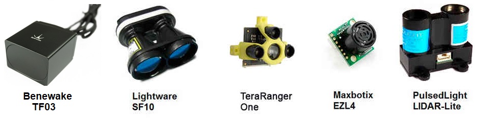
Rangefinders (landing page)
Copter/Plane/Rover support a number of different rangefinders including Lidars (which use lasers or infra-red beams for distance measurements), 360 degree Lidars (which can detect obstacles in multiple directions) and Sonars (which use ultrasonic sound). This category also includes Maxbotix Sonar and Pulsed Light LED range finders. These devices can be used for measuring distance near to the ground for precision landings and altitude control, water depth, or object distance as proximity sensors for Object Avoidance. Vision systems (see Intel RealSense Depth Camera) can also be used for Object Avoidance.
A forward facing rangefinders can also be used for Obstacle Avoidance. See Rangefinder Setup Overview to know more.
Warning
Many rangefinders are not included in the standard builds. If you get a pre-arm message that it is not being detected on power up, check the firmware’s included features list
Tip
If you get a “Bad LiDAR Health” message in Mission Planner this
is caused because the rangefinder isn’t enabled for landing. This is
done through the RNGFND_LANDING parameter and if set you should see
the message disappear.
Warning
RNGFNDx_MAX must be set to a tested, appropriate value. If RNGFNDx_MAX is set to a value
greater than the range of the sensor, the autopilot will not respond correctly to the
data provided.
Follow the links below (or in sidebar) for configuration information based upon your set-up.
Unidirectional Rangefinders
- Ainstein US-D1 Radar Altimeter
- Ainstein LR-D1 Radar Altimerer
- ARK DIST MR
- ARK DIST SR
- Attollo Engineering Wasp200
- Avionics Anonymous DroneCAN LIDAR Interface
- Benewake TF02-Pro / TF03 / TFS20-L / TF-Luna / TF-Nova / TF350
- Benewake TFmini / TFmini Plus
- Benewake TFS20L
- Garmin Lidar-Lite
- GY-US42 Sonar
- Hexsoon 24G Radar
- HC-SR04 Sonar
- JAE JRE-30
- LeddarTech Leddar One
- LeddarTech LeddarVu8
- LightWare SF10 / SF11 Lidar
- LightWare SF20 / LW20 Lidar
- Lightware SF02 Lidar
- LightWare GRF250 / GRF500 Lidar
- Maxbotix I2C Sonar
- Maxbotix Analog Sonar
- Nanoradar NRA24
- Nooploop TOF-Sense P
- Nooploop TOF-Sense F
- ST VL53L0X / VL53L1X Lidar
- TeraRanger One/EVO Rangefinders
- TeraRanger NEO