AIS (for boats)
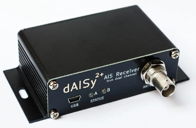
Rover supports Automatic identification system (AIS) sensors allowing the position of manned boats to be displayed on the ground station
Note
Support for this peripheral is also available for Planes and Copters using the Custom Firmware Build Server , by creating a firmware build including this feature listed under the IDENT category.
What to Buy
AIS compatible antenna (161.975 MHz and 162.025 MHz). VHF antennas including this one should work
AutoPilot connection
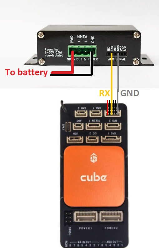
The dAISy2 should be connected to one of the autopilot’s serial ports as shown below
Autopilot Configuration
Connect to the autopilot with a ground station and set these parameters and then reboot the autopilot
AIS_TYPE = 1 (NMEA AIVDM message)
SERIAL1_PROTOCOL = 40 (AIS) if the sensor is connected to serial port 1. If another serial port is used please set the appropriate SERIALx_PROTOCOL parameter
SERIAL1_BAUD = 38 (38400 bps) if using serial port 1. If another serial port is used please set the appropriate SERIALx_BAUD parameter instead
MAV1_ADSB = 5 to enable sending AIS mavlink messages to the ground station over Serial0 (the USB port). If a telemetry radio is used the
MAVx_ADSBparam corresponding to its stream should also be set to 5(Hz).(Streams are numbered from first in order of Serial ports configured for MAVLink, MAV1 the first, MAV2 the second, etc.)
dAISy2 Configuration and Testing
Connect dAISy2 to your PC using a USB cable
Download, install and run a terminal program such as Putty
Connect to the dAISy2’s COM port at 38400 baud and press <ESC> to view the setup menu
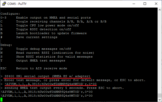
Type “3” to enable the serial port. “38400 8N1 serial output (NMEA HS w/ adapter)” should be displayed
Type “#” to save this change and retain this baudrate on boot
Type “T” to enable entering a test NMEA message and then copy-paste this message, “!AIVDM,1,1,,A,3815;hUw00wfUdHMPfQ4s8WT0D`r,0*00”, or hit “Enter” and use the default location
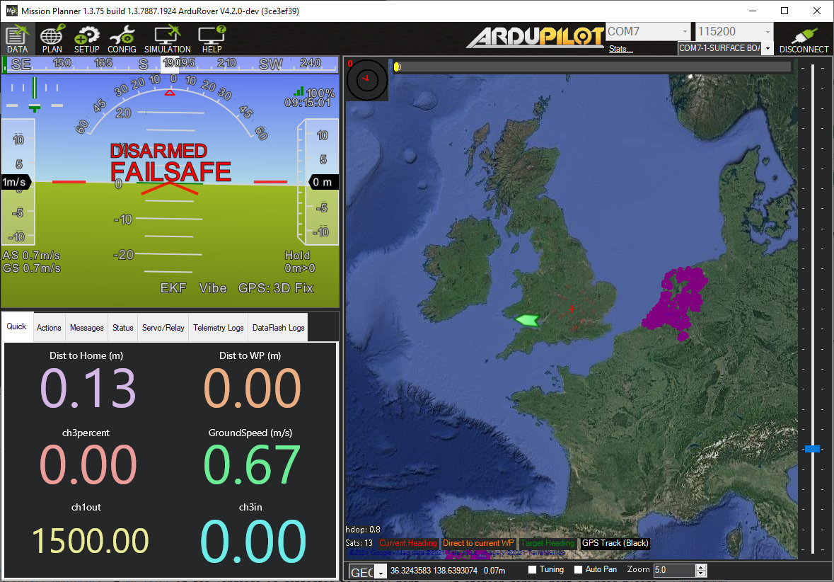
Connect to the autopilot with Mission Planner (or another ground station) and a boat should appear on the South West coast of England
press <ESC> to stop sending test messages
Avoidance
When path-planning based object avoidance is enabled, AIS vessel positions are automatically pushed into the Object Avoidance Database so that the vehicle can plan routes around them.
The database and path planning then operate as they would with any other obstacle source (lidar, proximity sensor, etc.). However, as AIS messages are sent infrequently a much larger OA_DB_EXPIRE value is needed so the database does not forget about a vessel in between AIS messages being received. A value of at least 600 seconds should be used (10 mins).
If the AIS message includes valid vessel dimensions (bow, stern, port, starboard distances from the transponder), ArduPilot computes the obstacle radius from those dimensions. If no valid dimensions are available, the database uses its configured OA_DB_BEAM_WIDTH for the obstacle size.
Logging
The AIS_OPTIONS parameter specifies which AIS messages are logged. These messages are useful for debugging purposes and contain the following information
TimeUS : System time that the AIS message was received
Num : Number of fragments in the currently accumulating message
Total : Fragment number of this sentence
ID : Sequential message ID for multi-sentence messages
Payload : Data payload