AirPixel ENTIRE R3 for Camera Control and EXIF Geotagging
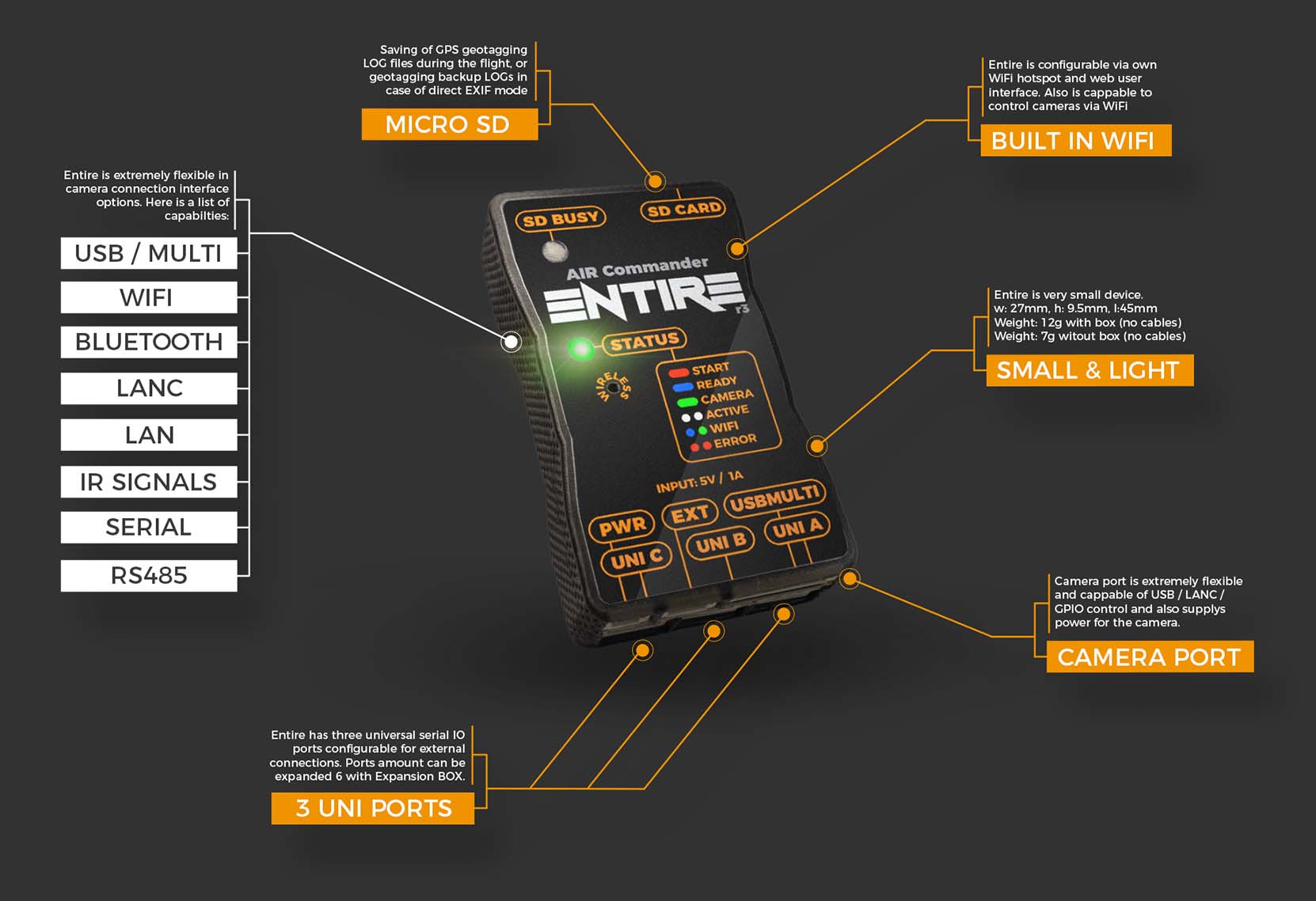
The ENTIRE R3 is a standalone device for GeoTagging of images in-camera SD card. GPS data data is read from the autopilot’s serial port (aka MAVLink bus) and is then saved directly into the photos using EXIF. The ENTIRE can also trigger the camera shutter via MAVLink commands, control video recording and zoom and many other commands.
Compatible with Sony A7 series, A9 Series and many other Sony models
Compatible also with ADTi cameras, ShareUAV cameras or ViewPro cameras
Photos are tagged (via EXIF) with the lat, lon, altitude and camera angles (read from the gimbal) within the camera
Optional geotagging of GPS/IMU accuracy, laser rangefinder and many more
HereLink implementation for camera control via MavCam (more info)
Mission Planner implementation via plugin
Supports taking pictures by distance flown or at intervals
Optionally uses configurable GPS position offset (X,Y,Z) to improve accuracy by lever arm calculations
High accuracy of EXIF saving - 1mm in distance
Geotagging available for JPG and RAW
Hot-shoe sync connector for reduced errors
GeoTagging is available at the maximum speed of the camera (even lower than 1s)
WiFi configuration and simple firmware updates
More info at www.airpixel.cz Documentation at www.airpixel.cz/docs