Choosing a Ground Station
This page gives a high-level overview of the available Ground Control Stations (GCS) and provides links so you can make the appropriate choice.
Overview
A ground station is typically a software application, running on a ground-based computer,phone,or transmitter, that communicates with your UAV via wireless telemetry or USB cable. It displays real-time data on the UAVs performance and position and can serve as a “virtual cockpit”, showing many of the same instruments that you would have if you were flying a real plane. A GCS can also be used to control a UAV in flight, uploading new mission commands and setting parameters. It is often also used to monitor the live video streams from a UAV’s cameras.
A GCS is also required to setup the configuration of the autopilot prior to its use and to update the autopilot’s firmware.
There are at least ten different ground control stations. On desktop there is Mission Planner, APM Planner 2, MAVProxy, QGroundControl, UgCS, and LOGOS. For Tablet/Smartphone there are QGroundControl, Tower (DroidPlanner 3), MAVPilot, AndroPilot and SidePilot that can be used to communicate with ArduPilot.
The decision to select a particular GCS often depends on your vehicle and preferred computing platform:
Ready-to-fly users may prefer the portability and ease of use of QGroundControl, or another GCS running on a tablet or phone.
DIY/Kit users and developers often have to access configuration and analysis tools, and would therefore need (at least initially) Mission Planner, QGroundControl, APM Planner 2 or another more full-featured GCS.
Code Developers will appreciate some of MAVProxy’s features.
Desktop GCSs
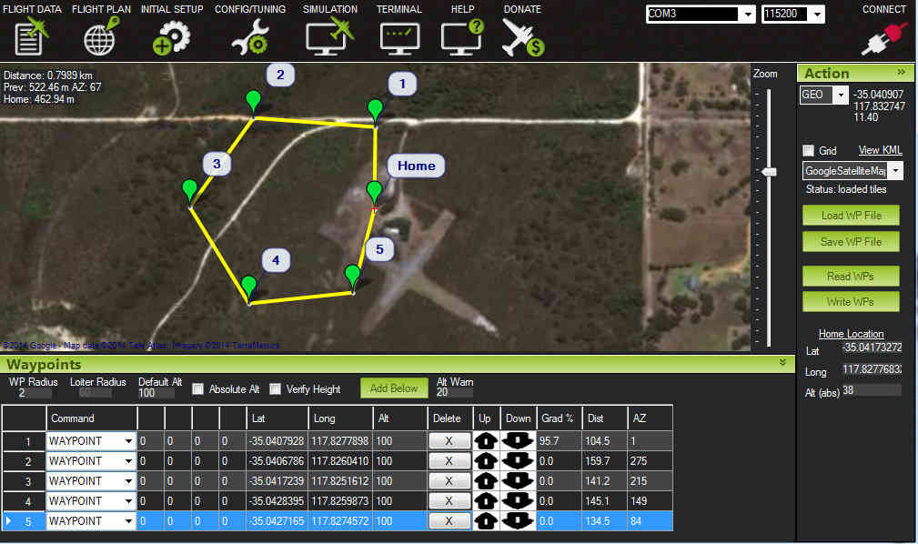
Mission Planner
Full featured and widely used GCS.
Platform: Windows, Mac OS X (Using Mono)
Licence: Open source (GPLv3)
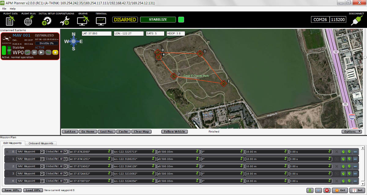
APM Planner 2.0
A GCS for use on macOS, Linux & Windows platforms. It has a smaller user base and a reduced feature set when compared with others.
Platform: Windows, macOS, Linux
- Licence: Open source
(GPLv3)
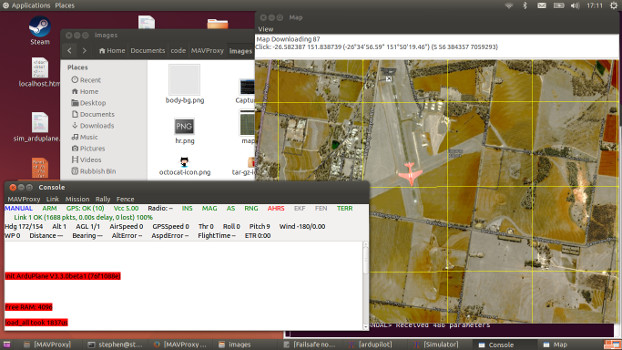
MAVProxy
Linux GCS often used by code developers. Primarily a command line interface with graphical modules for map and mission editing. Written in Python, and extensible via python modules.
Platform: Linux
Licence: Open source (GPLv3)
QGroundControl
QGroundControl works with MAVLink capable autopilots including ArduPilot. It’s unique among the GCS offerings as it runs on all platforms desktop and mobile.
Platform: Windows, Mac OS X, Linux, Android and iOS
Licence: Open Source (GPLv3)
UgCS - Universal Ground Control Station
Universal and easy to use ground control station with a 3D interface. Supports APM, Pixhawk as well as drones from other manufacturers such as DJI, Mikrokopter and more. Intended for enthusiasts as well as professional users.
It is capable of communicating with and controlling multiple drones simultaneously.
UgCS supports multiple map layers as well as different map providers. Some of the features of UgCS include - DEM Import, ADS-B transponder and receiver support, Click & Go mode, Joystick mode, image geotagging and video recording. UgCS also comes with a telemetry player, allowing the replay of all flights.
UgCS comes with in-built no-fly zones around all major airports as well as the ability to create custom no-fly zones.
Supports multi-node installation, meaning that it is possible to connect multiple pilots with UgCS laptops in the field to a central ground control server.
Platform: Windows, Mac OS X, Ubuntu
Licence: Proprietary with a free licence available as well (UgCS Open)
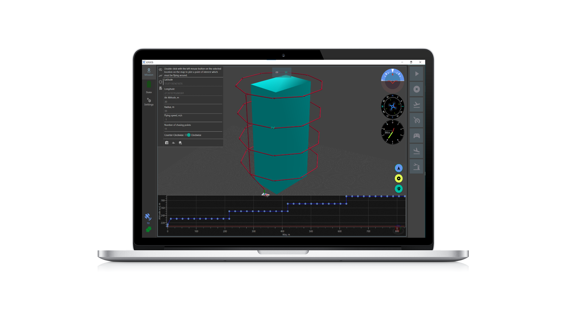
LOGOS
GCS designed to streamline the planning of complex missions that include area scanning, taking photos, & videos. It provides a 3D view mode, binding of physical structures and an in-built simulator that helps to better visualize planned missions.
Platform: Windows
Licence: Proprietary. Can be used freely, but advanced features are not available without purchase.
Mobile GCSs
QGroundControl
QGroundControl works with MAVLink capable autopilots including ArduPilot. It’s unique among the GCS offerings as it runs on all platforms desktop and mobile.
Platform: Windows, Mac OS X, Linux, Android and iOS
Licence: Open Source (GPLv3)
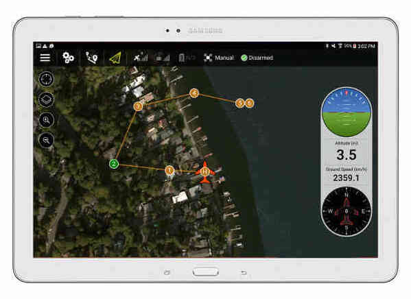
Tower
Tower (a.k.a. “DroidPlanner 3”) is an Android GCS for phones and tablets. It is intended for end users and enthusiasts, and includes features like follow-me, “dronies” (i.e. “selfies” but taken with a drone) and special missions for 3D mapping.
Platform: Android Phones and Tablets
Licence: Open source (GPLv3)
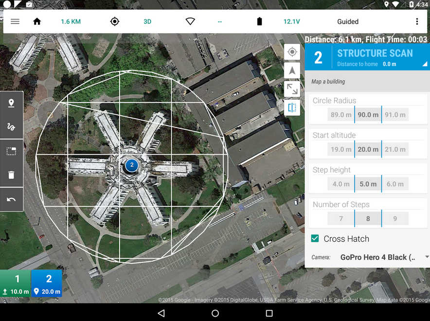
Download Tower (and 3DR Services) from Google Play.
Note
Legacy versions (DroidPlanner 2 and Droid Planner 1) can also be downloaded from Google Play.
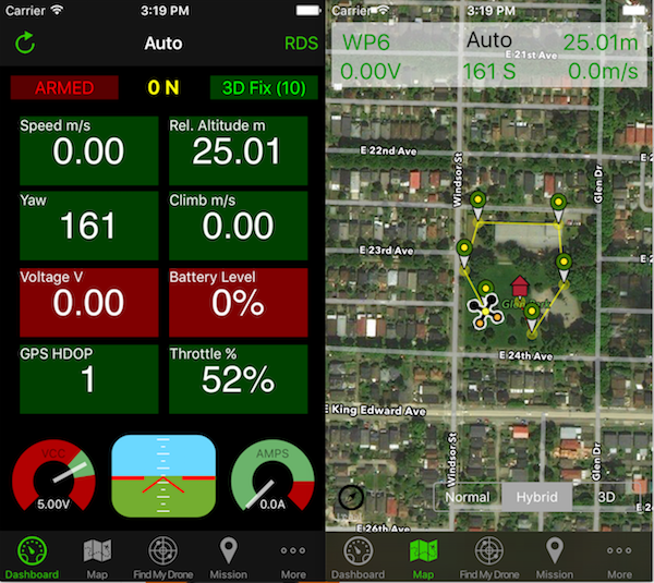
MAV Pilot 1.4
A GCS in your pocket that supports predominantly ArduPilot autopilot on iPhone/iPad. Supports for Plane, Copter & Rover vehicle types
See website for how-to on how connect it to your autopilot
Platform: iPhone, iPad
Licence: Proprietary
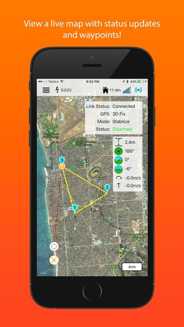
SidePilot
ArduPilot compatible GCS that runs on iPhone/iPad.
See website for how-to on how connect it to your autopilot
Platform: iPhone, iPad
Licence: Proprietary
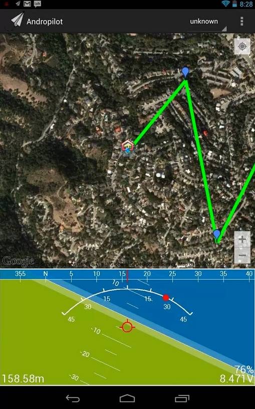
AndroPilot
Android GCS intended for enthusiasts.
Note
AndroPilot is not under active development. Its suitability for newer FW needs to be confirmed.
Platform: Android Phones and Tablets
Licence: Open Source (GPLv3)
Additional GCS hardware
Android
For Android devices, you will need:
Android based tablet or smartphone. QGroundControl can utilize Bluetooth, WIFI, or USB connectivity to the autopilot from the phone. For USB the device must be ablke to act as a USB host (OTG).
- A connectivity method to vehicle’s autopilot:
SiK Telemetry Radio System or other radio telemetry (Telemetry (landing page)) with OTG cable can be used for long range, in-the-air, connectivity to a similar vehicle telemetry unit.
WIFI (ESP8266 wifi telemetry)
Bluetooth (Bluetooth Telemetry radio)
for benchtop USB connectivity, a USB OTG cable (typically less than $2 on ebay and Amazon ).
Some other telemetry method (Telemetry (landing page))
iOS
For iOS devices, you will need:
iOS Based devices such as an iPad or iPhone. If running iPad, the cellular version is recommended for better GPS support.
Wifi or Bluetooth LE link to the Drone
Bridge Connection to a SiK Telemetry Radio System via Wifi or Bluetooth LE
See iOS App Vendors for more details.
Desktop PCs (Windows/Mac/Linux)
For Desktop devices you will need:
A USB cable, BT module, WIFI adapter, or other connectivity means as listed here (Telemetry (landing page))